| |
|
|
| Brisbane to Guy Fawkes River National Park |
|
Week 1 - June 27th 2010 |
| |
|
|
 |
|
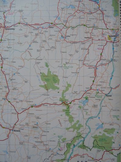
Day 1 - Ipswich to Koreelah via Boonah
Hema 7 Page 6 |
| |
|
|
 |
|
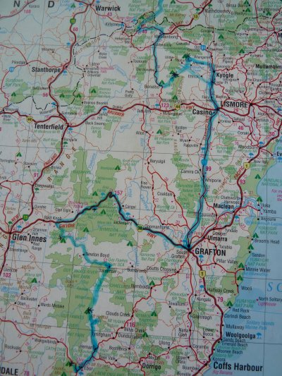
Days 2 - 8 Koreelah to Chaelundi (Guy Fawkes River NP) via Richmond
Range, Casino, Grafton, Gibraltar Range NP.
Hema 7 Page 29 |
| |
|
|
 |
|
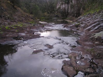
On the road at last. South from Brisbane, just across the NSW Border, to
Koreelah. A pleasant waterfall and this creek downstream. At least 5
minutes from our campsite. Late in the
evening when we arrived but "we've started our travels."
Amid the busy time of preparation we haven't really had time to think
too much. At this first camp site we started the routine of life in a
truck. Still haven't time to be excited.
|
| |
|
|
 |
|
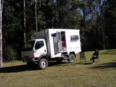
Peacock Creek camp site in Richmond Range National Park is
a clearing in the rain forest. Tall pines at one side beyond the truck.
Warm enough in the sun to sit outside and contemplate. |
| |
|
|
 |
|
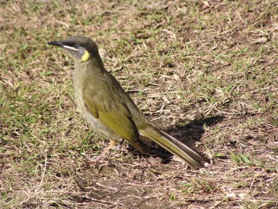
The "ping" of a myriad bellbirds provided
background music. Fortunately not overnight. Watched them in the treetops
for several hours. Increased activity and much excitement as they
irritated a hawk until it flew off. This one stayed on the ground long
enough to pose for a photo.
It seems nature is set to dominate our travels. |
| |
|
|
 |
|
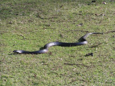
Also had the pleasure of the company of this snake. Haven't
a clue what sort but it looked nasty. |
| |
|
|
 |
|
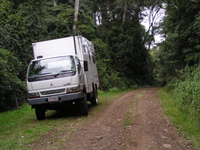
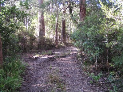
The rain forest road from Peacock Creek to Iron Pot Creek
camp site. Easy going really, but slow due to corners and hills. |
| |
|
|
 |
|
Looking North to Mt Lindsay from Sherwood Lookout. Seems
like we haven't really come very far, its on the border and almost visible
from home.
Intention was to backtrack from the lookout and head South. A couple of
locals stopped for a chat and knew that the "road" headed
towards the coast and met the main road.
Our first small adventure as we descended the ridge on the road which
didn't rate a mention on our map book. We passed through Grafton. |
| |
|
|
 |
|
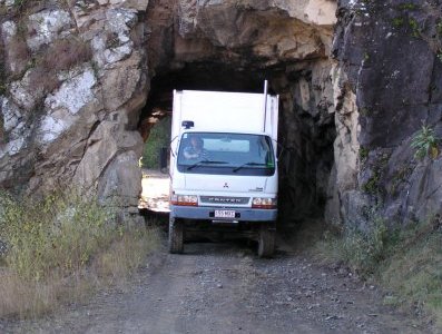
On the old Glen Innes to Grafton road we drove through the
"convict tunnel". 20m long it was dug in 1866.
Ali thought there was lots of room, and who was I to argue! |
|
|
|
 |
|
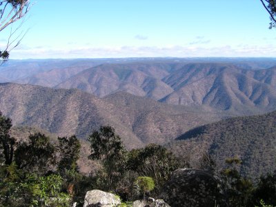
Misty Creek Lookout. It seems the country stretches
forever. Enough to keep us occupied for the rest of our lives. |
|
|
|
 |
|
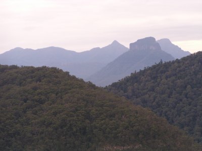
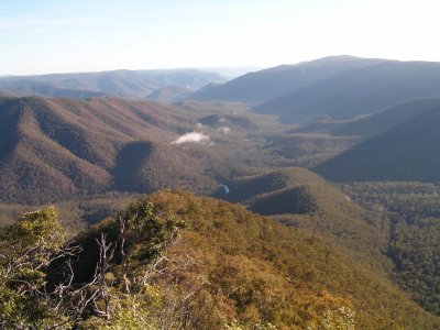
Lucifer's Thumb is a ridge overlooking Guy Fawkes River. We
camped at Chaelundi Creek above the East side of the River. Narrow,
twisty, roads.
This was Guy Fawkes River looking North just after dawn. We rose early
and walked a couple of kilometres.
In 30 years there has been a proliferation and aggregation of National
Parks along the spine of the Dividing Range. We are slowly making our way
South on the many back roads. |
|
|
|
 |
|
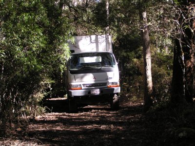
We almost met our nemesis in the last 50m of the track to Mt Hyland.
Facing up a 15 degree slope on a narrow track and a bit of a bend. The rear end slipped
sideways (to the right of the picture) about 1m. That left the rear of the
truck about 3m in front of a tree. Rear wheels were slipping so no way
forward or backward.
While attempting to free ourselves we discovered that 4wd wasn't
working. A free wheel hub didn't engage. Also discovered that fuel pick up
from a half full tank is not very good at 15 degrees. Decanted fuel from
one almost empty tank to the half full one.
Took about 3 hours of digging, placing vegetation under the rear wheels
and decanting.
A "learning opportunity" as they say.
|
|
|
|
 |
|
It doesn't look much but the marks from the rear wheels can
be seen.
Free wheel hub was later fixed in Canberra.
The good news was that both rear wheels were slipping. Took it as a
sign that the limited slip differential was working well.
Nevertheless, this little incident shook our confidence for a bit.
Perhaps just as well, we met some slippy roads a bit later and had a sense
of when to stop.
Freeing ourselves was a good feeling though. The thought of pushing 4.5
tonnes uphill was a bit much! |
| |
|
|
| Cathedral Rock National Park to Abercrombie NP |
|
Week 2 - July 5th 2010 |